October 19, 2017 Thursday
The lockmaster at the Mel Price Dam (mm 200.8-11 feet) likes for all recreational boats leaving Alton Marina to arrange a time to lock though together. This morning there were only two of us, m/v Courageous, crew Terry and Joanne, and Andiamo. We left the marina at 7:00 am and were entering the lock at sunrise, another lock that we were allowed to float through.
Our next lock, Chain of Rocks, was 15.8 miles away. By the beginning of the 1940’s the Mississippi River had been “tamed” by a system of locks and dams from Minneapolis to Alton, but seamen still faced the challenge of navigating a series of rock ledges and shelves that extended from the confluence of the Mississippi and Missouri Rivers to St. Louis. The solution, the US Army Corps of Engineers designed and built the Chain of Rocks canal to bypass the area.
At the end of the canal is the double chamber Chain of Rocks lock and dam (mm 185 – 7 feet). As Andiamo and Courageous entered the auxiliary chamber m/v Cherokee entered the main chamber. Again we were allowed to float but this will be our last time floating. We have three more locks, two on the Ohio and one on the Cumberland, both will be going up which is usually more turbulent than going down so we will use the bollards to transit those locks.
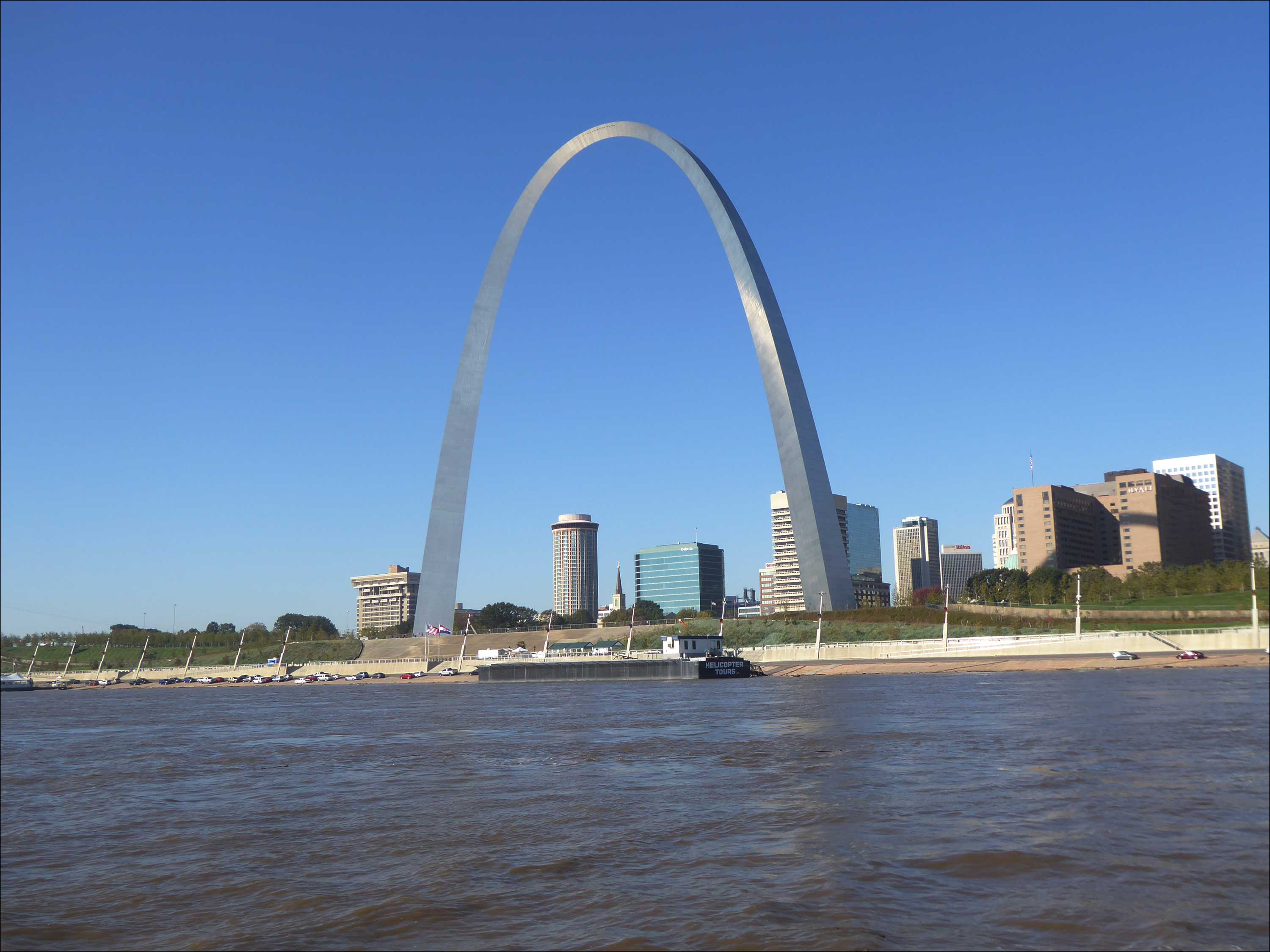
The Saint Louis Harbor was all it promised to be and more, many tows and barges moving on the river with even more anchored along the side. The current was swift and lots of logs peppered the river. A bit tense but all went well and we were at Hoppies Marine Services and tied to their barges by 12:30. Hoppies is legendary. Started in 1936, Hoppies father lit the kerosene navigational lanterns on this part of the Mississippi River and now Hoppies wife, Fern age 80, gives an evening briefing on the current stages of the river in terms of anchorages, locks, and other factors concerning the navigation of the river. The briefing was very beneficial, we learned about anchorages that are no longer viable, an anchorage that we were not aware of, and wing dams. Wing dams are barriers that extend partway into a river and force water into a fast-moving center channel. This slows the water flow near the river banks and reduces the rate of sediment accumulation in the channel.
Tonight we have a train track 1000 feet from our port side and the Mighty Mississippi on our starboard. Current is strong and wakes from tows/barges promise to keep us rocking all night. The next marina and the next chance to get fuel is in Paducah, KY, 205 miles away. Our decision for tonight is, do we go to the Little River Diversion Channel, 110 miles away, or to Kaskaskia Lock just 41 miles away. With the current Kaskaskia will be a short day but 110 miles on the Mighty Mississippi will be a long day. The portion of our trip from here to Green Turtle Bay promises to be quite interesting. Our friends that left Alton on Monday arrived at Green Turtle Bay tonight. I texted them to see how the trip was I got a two-word response, IT SUCKED!

